


The Photographer Documenting Saudi Arabia From the Sky Down
Saudi Arabia holds thousands of natural secrets. Meet the team of volunteers who are photographing them from the sky.
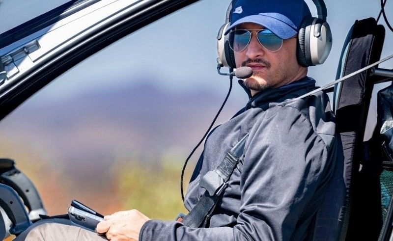
Abdulaziz Aldakheel has always been drawn to the sky.
While most look upwards to see clouds or washes of blue, Aldakheel imagines what it would be like to look down - to inhabit the sky itself, gazing down on Earth.
“For me, aviation was never just a passing interest,” Aldakheel says. “From an early age, I was always drawn to the sky, curious about flight and the world above.”
Now, a pilot based in Saudi Arabia, Aldakheel uses photography to show people his view from the skies. “From the air, I became fascinated by the landscapes below, especially the ones that stood out for their uniqueness,” he says.
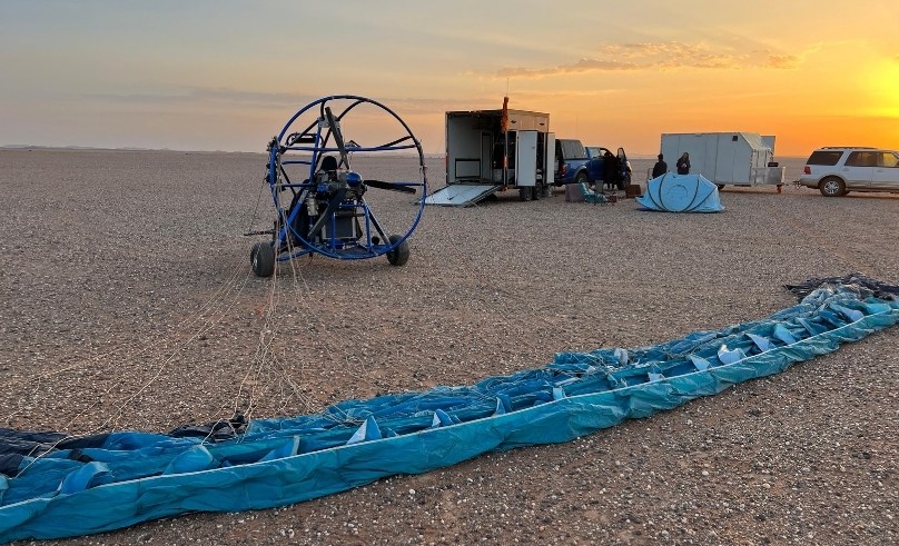
His journey into aviation began to take form while in university in Florida, where Aldakheel would take flying lessons during weekends. Upon his return to the Kingdom in 2014, he acquired a small ultralight aircraft - one with just one or two seats - around the time they started gaining popularity in Saudi Arabia.
Aldakheel’s career in photography began while on one of these flights, hovering over a volcanic mountain. From that small and intimate plane, the world looked nothing like what most people ever get to see - and he wanted to share it. “I was surprised by the strong reaction it received from friends and relatives,” he remembers. “This was before drones became widespread, so all my aerial shots depended entirely on manned flights.”
Conveniently, social media was also taking off around the same time, providing Aldakheel a platform to share these images more widely. “As my passion grew, I began exploring and photographing more remarkable locations, both natural and historical,” he says. “It didn’t take long for me to realise just how rich Saudi Arabia is in unique landscapes and sites of historical significance."
This vastness in landscape made Aldakheel realise he couldn’t document it all alone, and in 2015, he and a fellow aerial photographer founded the ‘ERTH Aerial Documentary Team’. "We needed a fully integrated team with a shared vision". Today, that team brings together pilots, photographers, geologists, and historians, all working voluntarily to document the Kingdom's natural, archaeological, and historical sites.
ERTH, in Arabic, translates to heritage or legacy - what a person leaves behind after death. It is an unusual name for a photography team, yet it alludes to a core aspect of the team’s mission: to document the natural history that has been given to them.
"I came to realise that aerial photography could be a powerful tool for documenting Saudi heritage," Aldakheel says. “I understood that a single image can be worth a thousand words - and that one photograph of an archaeological site can convey entire chapters of its history." What the team captures, they submit to a relative authority in the Kingdom as part of a national initiative, building an archive of landscapes that might otherwise go unseen and unrecorded.
Their season follows the Saudi winter, running from early November through to the end of March, when cooler temperatures and clearer skies make conditions ideal. "We dedicate our weekends and official holidays to exploring and documenting natural and archaeological sites in the Kingdom's most remote areas," Aldakheel says.
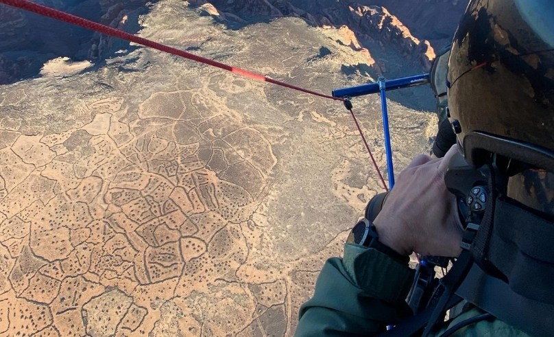
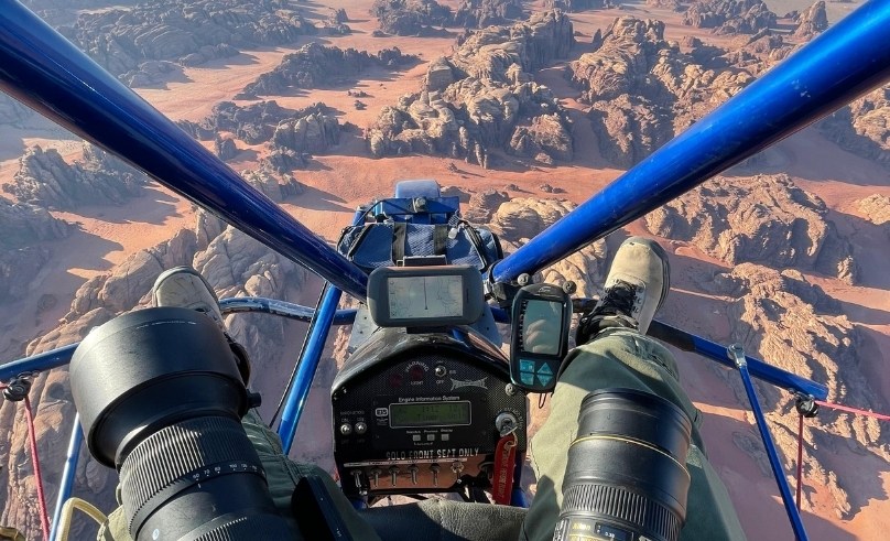
Not all places are accessible to the ERTH team, however. Some sites fall within no-fly zones; others are simply too small to justify the extensive logistics that a manned aerial shoot demands. But certain sites, Aldakheel says, are "exceptionally important" - those that combine multiple qualities in a single location: archaeological or natural significance, remote settings, unusual formations, or a certain “visual quality that merges beauty with uniqueness.” When capturing one of these places, the team often deploys on-ground photographers alongside those hovering above. These multiple viewpoints are a way for the team to best capture and document these heritage sites - particularly in places still unseen by the public.
For Aldakheel, the work has always been about the land, not the people documenting it. "I see my work primarily as documentation," he says simply. "I do not pursue personal recognition - my focus remains on the mission that inspired the team's creation." Any success the team achieves, he is quick to point out, belongs not to ERTH but to the sites themselves. "Any work we do highlights the Kingdom’s treasures rather than the individuals or team behind the camera," Aldakheel explains humbly.
Yet, despite the team’s quiet sense of purpose, aerial photography is anything but easy. Weather can ground a team that has travelled hours to reach a remote site; permits and logistics can break even the most carefully planned mission. Over the Khaybar lava field - one of the Kingdom's most breathtaking geological sites - the sheer scale of the terrain and boiling lava weaving through it demanded shots from extreme altitudes, high enough that the team required supplemental oxygen to operate. "By God's grace, the mission was completed successfully," Aldakheel says, "despite the high level of risk and adventure involved."
Another mission brought its own kind of difficulty: documenting the date harvest from the air, with farmers perched high in palm trees, tiny and difficult to spot from above. “Capturing this process from an aircraft proved to be an exceptionally challenging task,” says Aldakheel.
To Aldakheel and the volunteers who make up the ERTH team, they are mere translators for the land they capture. “Any success we achieve is ultimately a reflection of that heritage.” Hovering above the land, they document their country’s heritage without ever disturbing it - leaving no footsteps or traces behind.
- Previous Article Virtual Reality Exhibition Hall Approved at NMEC in Fustat
- Next Article The Ancestral Resilience of Omar El Farouk’s Fayoum Home